
Premium Weather Update September 30, 2026
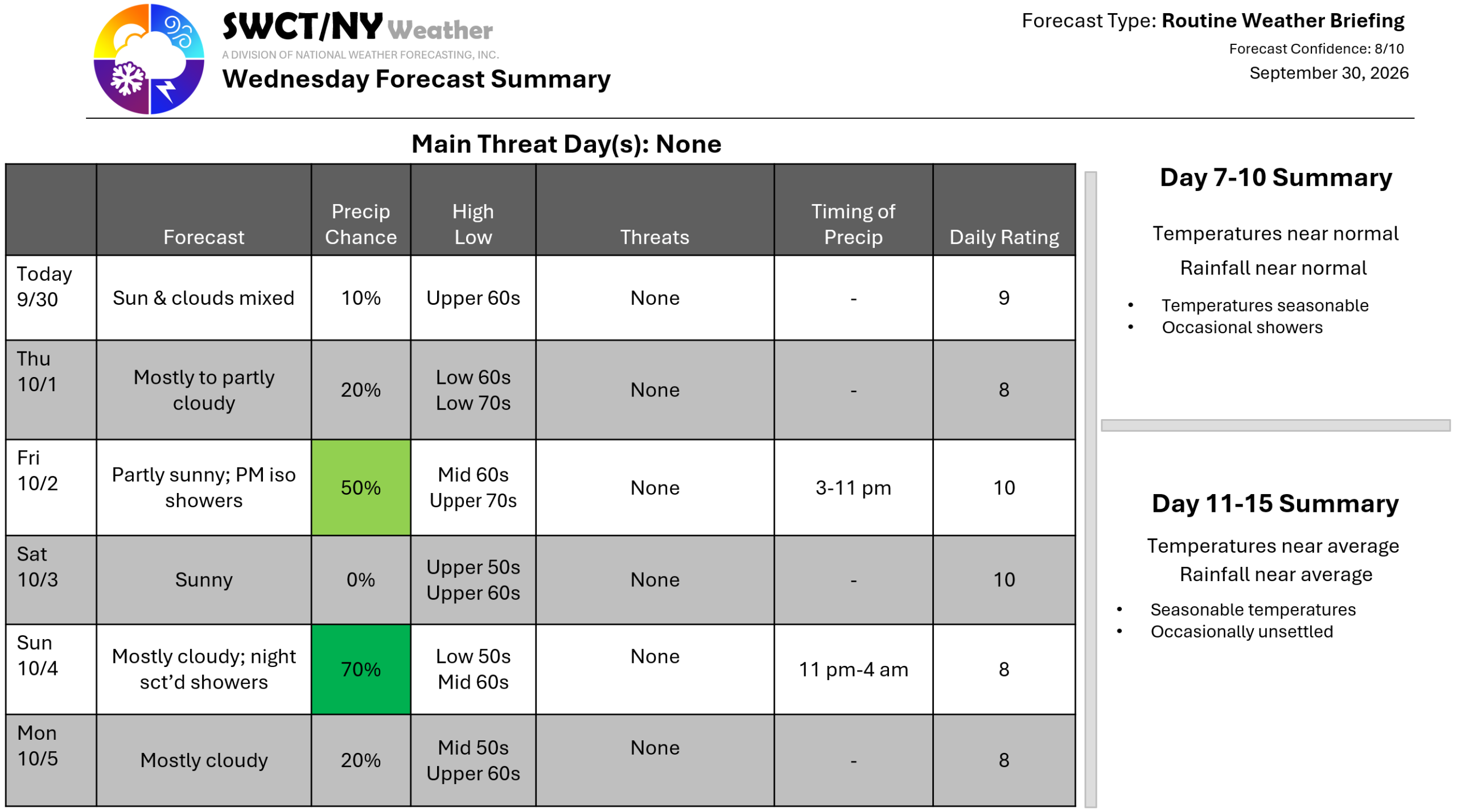
Good day! Surface high pressure across the region keeps us generally dry through late Sunday evening. A cold front moving through from the eastern Great Lakes offers widely placed light showers Friday afternoon through late evening with a cooler less humid air mass to follow for the weekend. Before this cold front moves through; we’ll see a taste of late summer Friday afternoon with temperatures near 80 & a bit of humidity. Temperatures return to near seasonable levels for the weekend with a risk of showers Sunday nigh through early Monday morning as some energy passes by to our south. This part of the forecast has room to trend even drier! – Joe Sciacca
