Premium Weather Update April 10, 2026
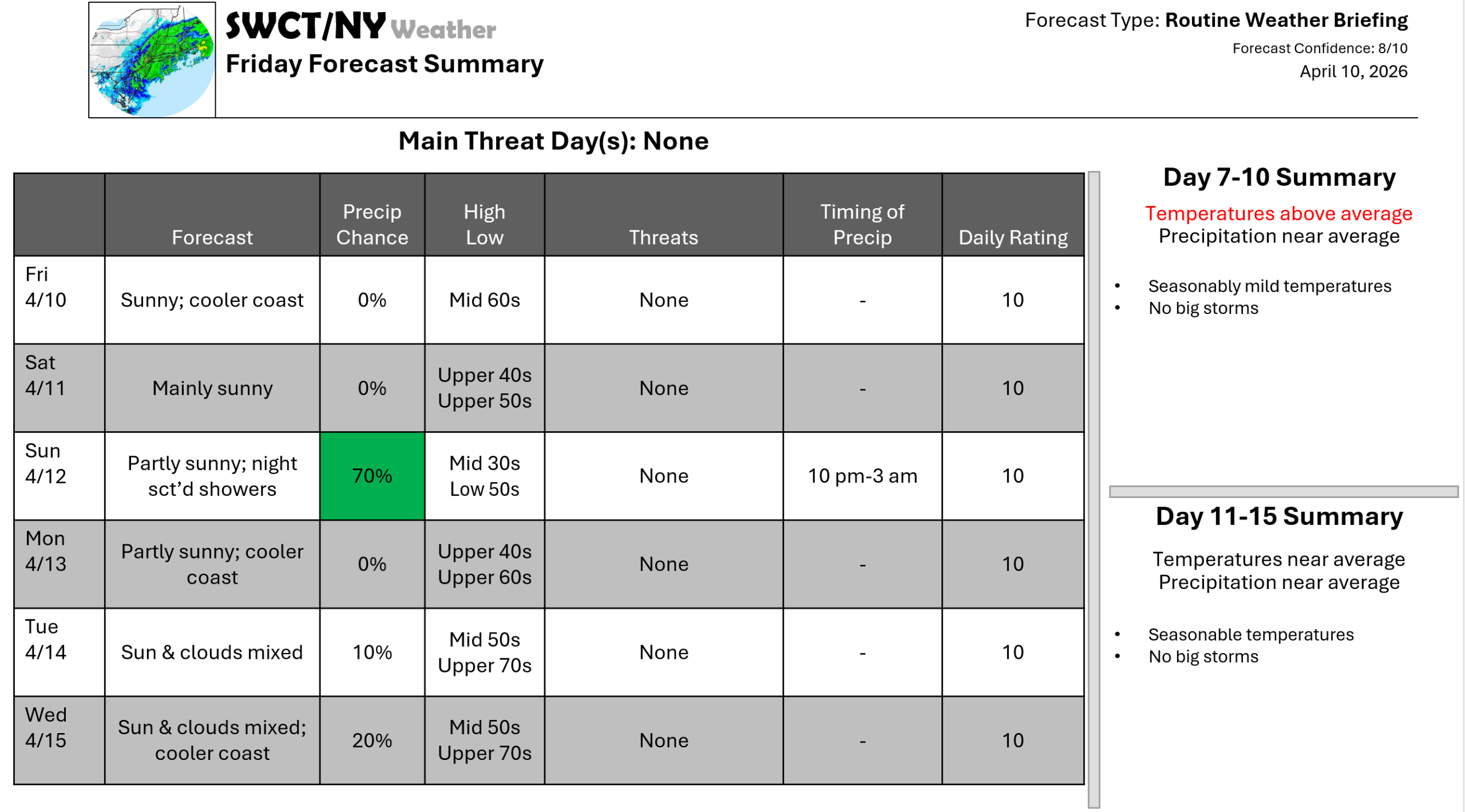
Good day! Slightly above normal temperatures are expected today with well above normal temperatures for next week as a strong ridge of mid-level high pressure builds over the region. High temperatures will be cooler along the coast thanks to an onshore wind. Surface high pressure keeps us mainly dry through the end of next week. A warm front moving through from our southwest Sunday night into early Monday morning offers a low risk of a passing rain shower. A cold front looks to move through from the Great Lakes at some time next weekend offering some rain & cooler temperatures to follow.
– Joe Sciacca
Be sure to update your account on the new swctweather.com/nationalweatherforecastinginc.com and watch for a resubscribe/renewal special in your inbox
