Premium Weather Update April 20, 2026
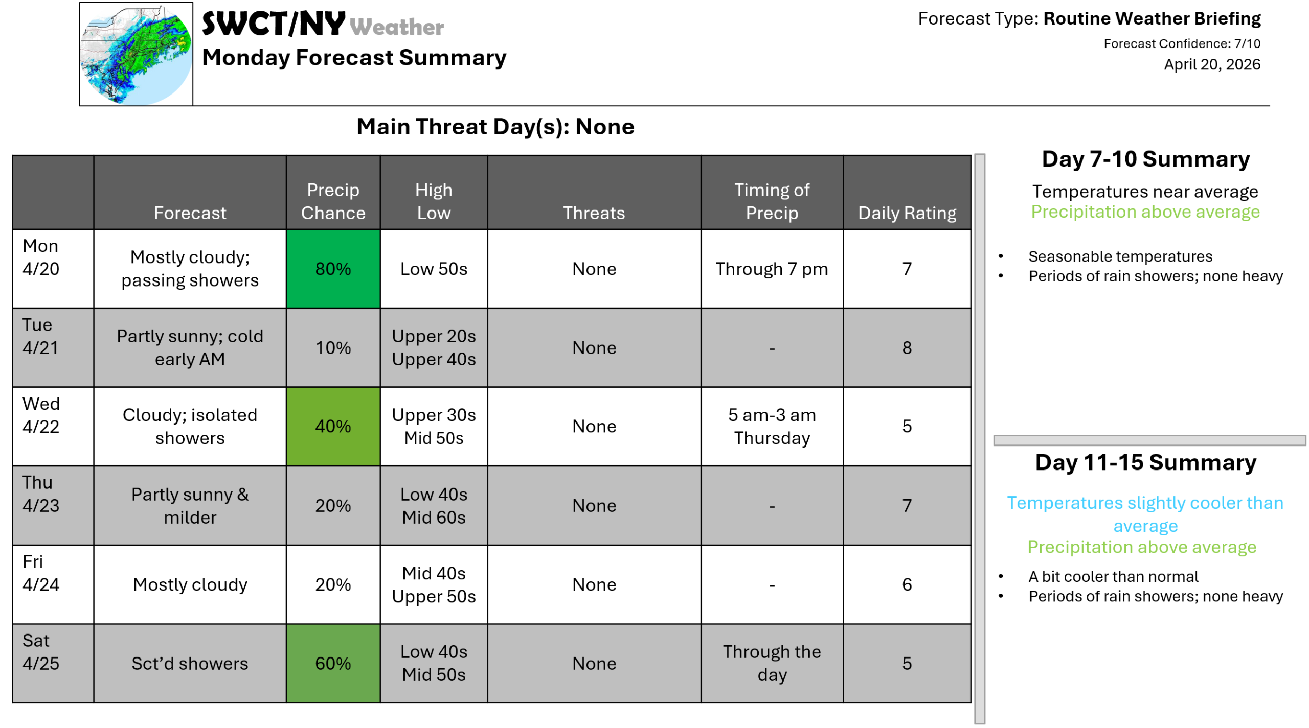
Good afternoon! Most of the upcoming week is settled with varying cloud cover along with overall seasonable temperatures. It will be on the cold side again tomorrow morning with a killing freeze for many with air temperatures in the upper 20s for most with some mid 20s. Sensitive plants that are growing will be impacted if not brought indoors. Some energy moving through this afternoon from the eastern Great Lakes offers passing hit & miss rain showers with yet another risk of showers Wednesday into the predawn hours Thursday & through the day Saturday as more energy moves through from New York. Thursday also is the mildest day of the forecast. No major weather events in sight.
-Joe Sciacca
Be sure to update your account on the new swctweather.com/nationalweatherforecastinginc.com and watch for a resubscribe/renewal special in your inbox
