Premium Weather Update April 17, 2026
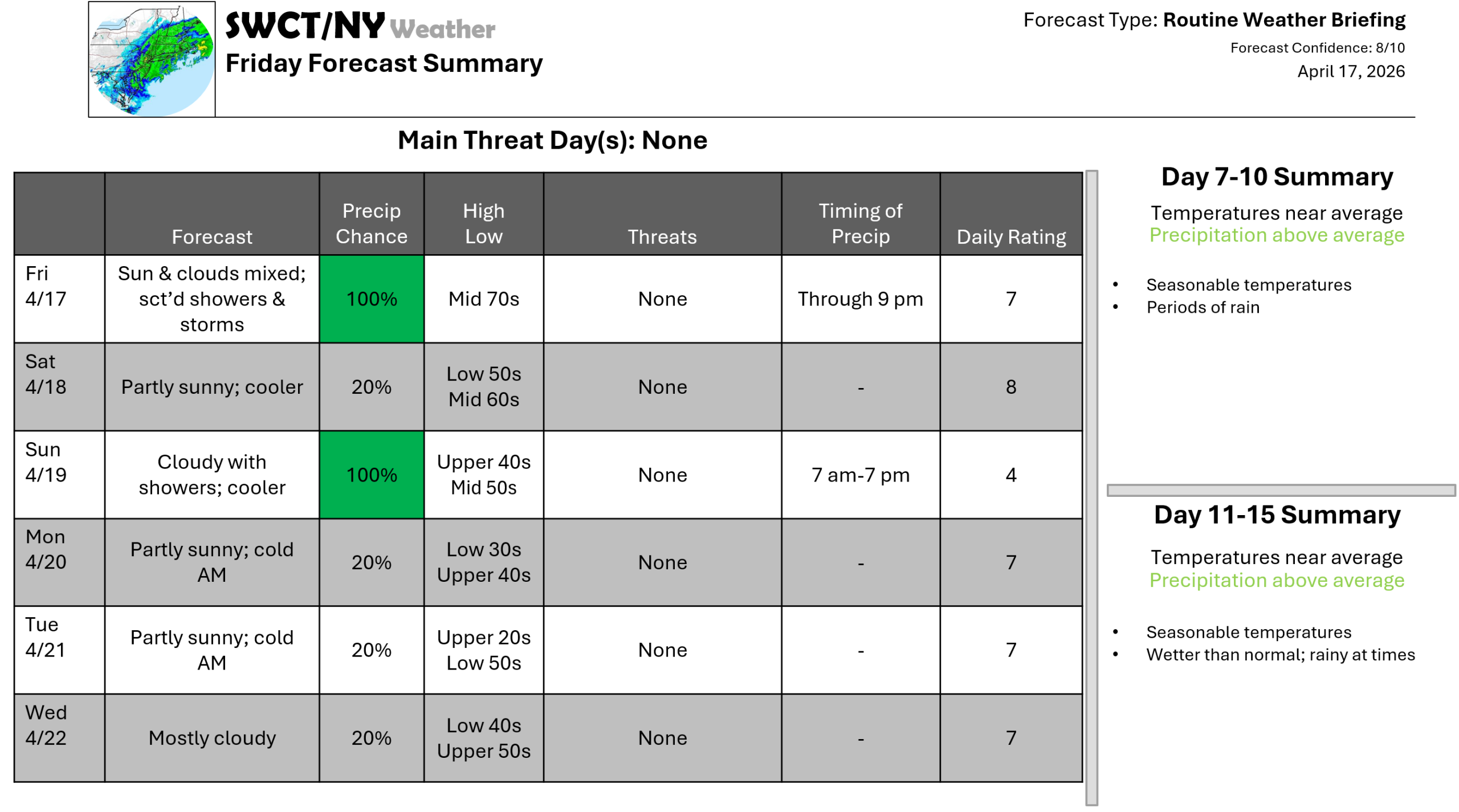
Good afternoon! We are a bit unsettled this afternoon as some energy moves through from our west & north offering hit & miss showers & thunderstorms. No strong to severe storms are expected. The start of the weekend is dry with a mix of sun & clouds as surface high pressure builds in from the Great Lakes out ahead of a strong cold front moves through from the Great Lakes bringing rain Sunday with cooler temperatures to begin next week as a new ridge of surface high pressure builds in from the Great Lakes with varying cloud cover. A killing freeze is likely for many Monday & Tuesday morning. A bit of moderation is likely by the middle of next week.
-Joe Sciacca
Be sure to update your account on the new swctweather.com/nationalweatherforecastinginc.com and watch for a resubscribe/renewal special in your inbox
