
Premium Weather Update May 20, 2026
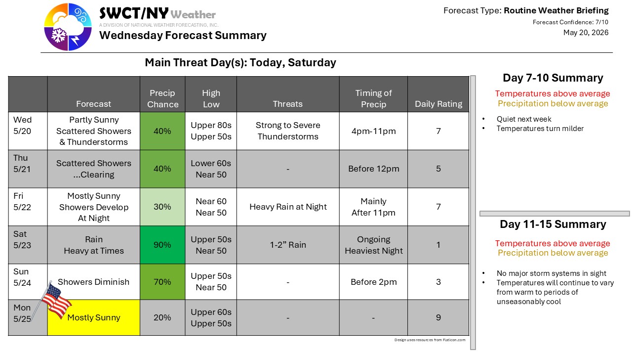
Well, summer had a good run! A cold front approaching today will trigger some scattered showers and thunderstorms as it approaches; we’ve got the potential for heavy downpours and strong storms with frequent lightning and gusty winds – but limited to areas in and around the storms. Behind the main push of strong storms, additional rainfall will develop, likely lighter, but persistent into early Thursday before we dry out. The frontal boundary sags southward, stalls, and pushes back northward for the weekend – it’ll be reloaded and ready to produce some steady, heavy rain – a soaking washout looks like a good bet for Saturday, while conditions are very slow to improve Sunday. This is why we have three days for the holiday weekend – Monday looks just fine!
-Phil Spevak
