
Premium Weather Update July 20, 2026
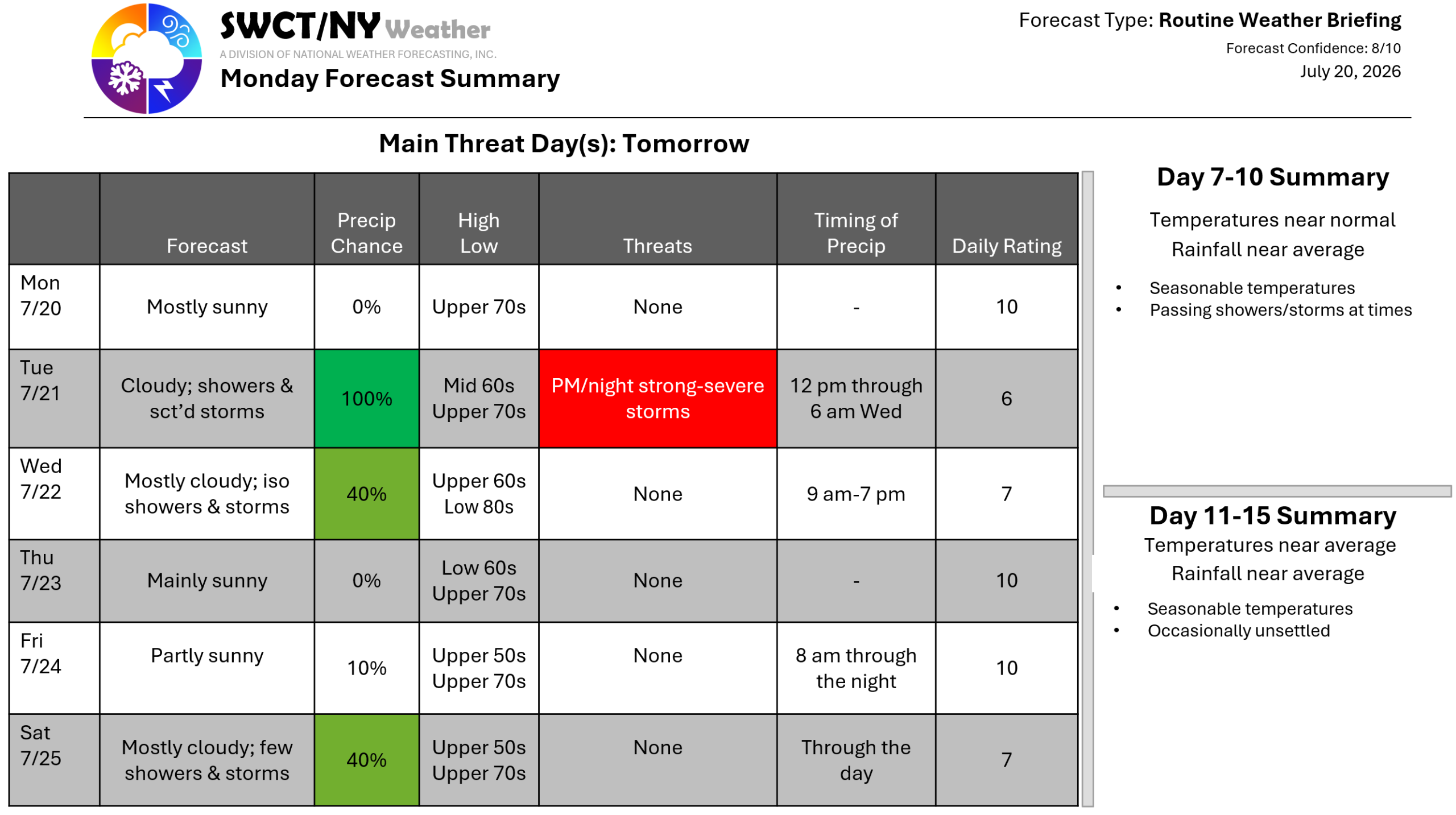
Good afternoon! Surface high pressure building in from the Great Lakes provides us with settled conditions today through tomorrow afternoon. By early tomorrow afternoon we become a bit unsettled as some energy moves in & through from the eastern Great Lakes offering hit & miss showers & storms that linger through Wednesday afternoon as a cold front takes shape & moves across the region from New York. There is a low risk of severe storms being capable of damaging wind gusts from 3-8 pm tomorrow. By weeks end we dry out as a new ridge of surface high pressure builds in from the Great Lakes. Some more energy moving in from our southwest offers a few showers & storms to start the weekend. Slightly cooler than normal temperatures are forecasted through the weekend.
– Joe Sciacca
