
Premium Weather Update September 23, 2026
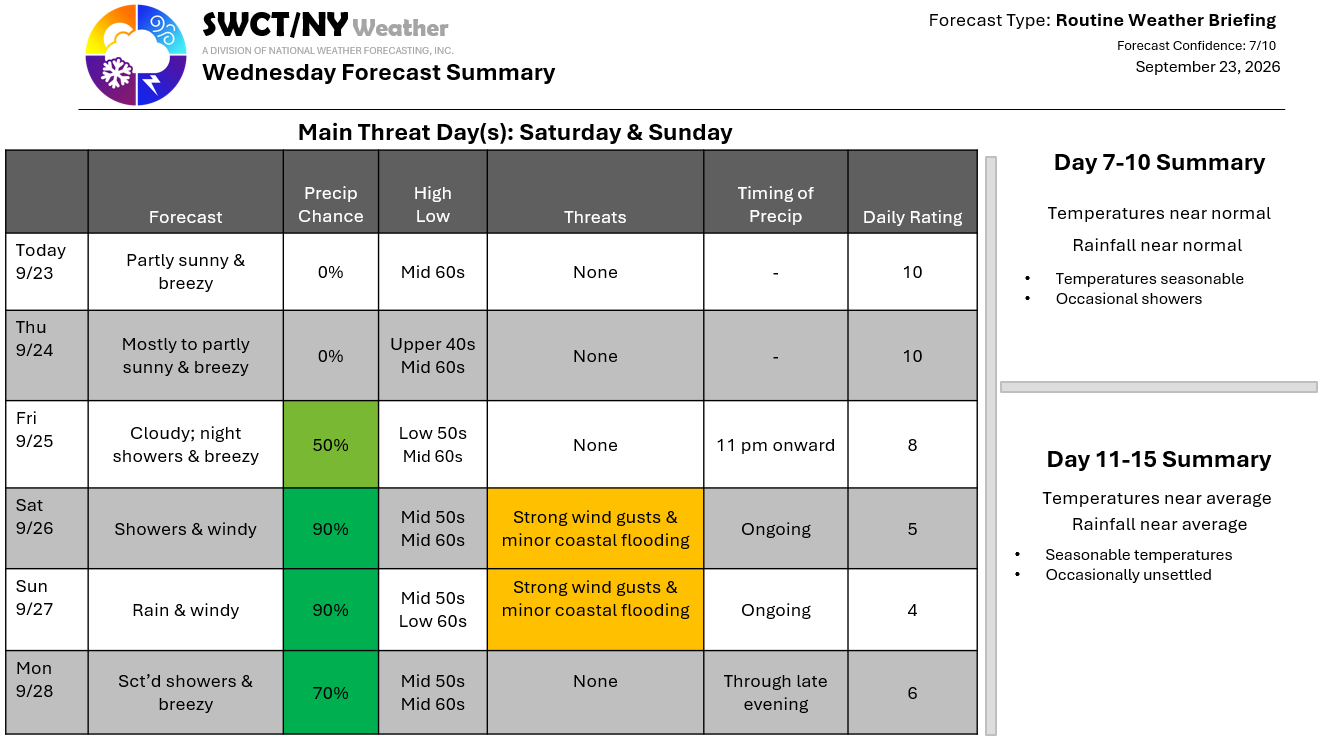
Good day! Strong surface high pressure centered across southern Canada provides us with a mix of sun & clouds today & tomorrow along with a gusty breeze up to 35 mph as our weekend coastal storm gets underway well to our south in between Bermuda & the Outer Banks of North Carolina. Clouds increase tomorrow night into Friday as our system moves northward. There is still decent uncertainty in the forecast of the storm. If the storm is further west south of Long Island; rain & wind will be more impactful & if the storm is further to our south & east; rain & wind will be less. As of now it appears that the storm center will most likely end up just south of Block Island Saturday & slowly wind down Sunday into Monday as it stalls thanks to strong high pressure across southern Canada.
Rainfall of 1-2″ looks most likely across the region with wind gusts up to 40 mph out of the north & up to 45 mph at the coast. Strongest winds Saturday & Sunday. There is the potential for some minor coastal flooding at the coast around high tide during the weekend. Further forecast confidence by Friday. – Joe Sciacca
