
Premium Weather Update October 12, 2026
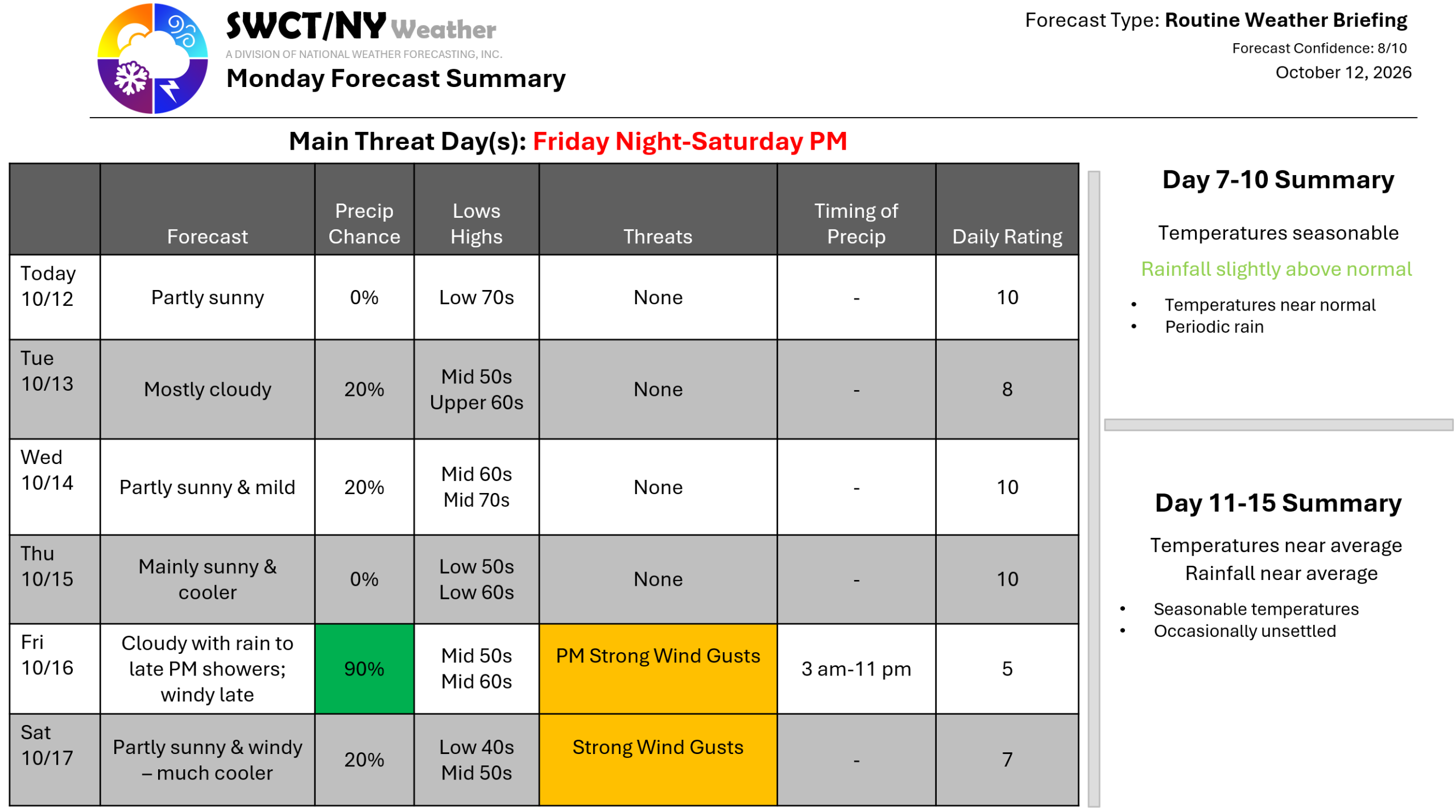
Surface high pressure across the region keeps us settled through late week. A weak storm system passing by to our north through the day tomorrow across northern New England offers increasing clouds. Once this system clears to the east; well see a bit of moderation in temperature for Wednesday with a mild night tomorrow. Thursday features cooler temperatures as a dry cold front moves through from our north with a mainly sunny sky. The biggest feature of the week is a robust storm system & cold front moving through from the Great Lakes which provides rain; steady at times through the day Friday that tapers to a few showers late Friday evening as well as a robust fall in temperatures for the weekend. There is the potential for strong wind gusts up to 45 mph out of the northwest Friday night through late Saturday afternoon as our storm system deepens across Atlantic Canada & as strong surface high pressure builds in from the Great Lakes. – Joe Sciacca
