
Premium Weather Update October 14, 2026
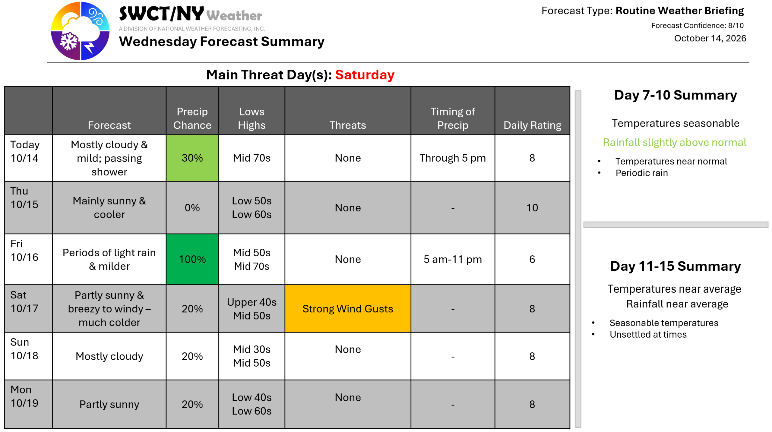
Some energy moving through the area from the west offers a low risk of passing light showers through late this afternoon. Surface high pressure across the region keeps us largely settled through about the start of the morning commute Friday when a cold front moving through from the eastern Great Lakes provides periods of light rain as a storm center passes by to our north across the Canadian border. Temperatures vary day to day through Saturday with a robust burst of colder than normal temperatures arriving Friday night in the wake of our cold front as strong surface high pressure builds in from the Plains. We’ll see a period of breezy to windy conditions Saturday early morning through mid afternoon with northwest wind gusts up to 40 mph. Will be close to some frost & freeze Sunday morning with lows 30-35. – Joe Sciacca
