
Premium Weather Update October 16, 2026
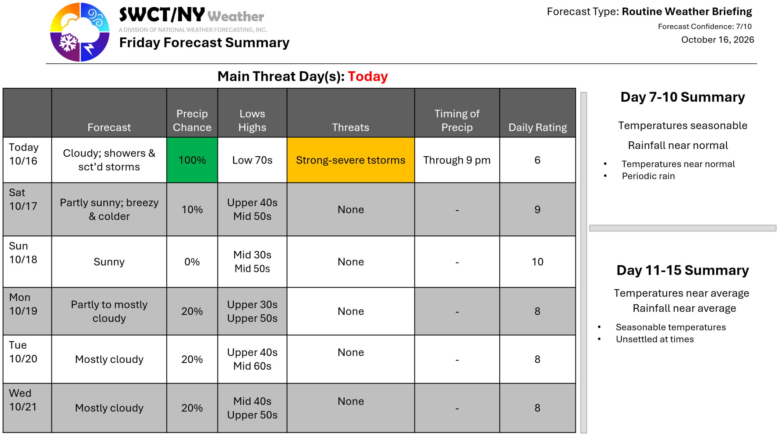
Happy Friday! A robust cold front moving through the region today from the far eastern Great Lakes offers passing showers & a few thunderstorms. There is the potential for strong to severe storms being capable of producing strong to damaging wind gusts with little to no lightning. Timing of storms is from 4-8 pm as they move through from the west. Lingering light showers through about 9. Behind this cold front; much cooler temperatures settle in from southern Canada on a gusty northwest wind gusting up to 35 mph tonight through tomorrow afternoon as a ridge of surface high pressure builds in. Sunday morning features the coldest temperatures of the season so far with frost & freeze being widespread. Temperatures moderate by Tuesday to near average. A storm system well to our south provides more clouds than sun for a good part of next week. – Joe Sciacca
