
Premium Weather Update September 9, 2026
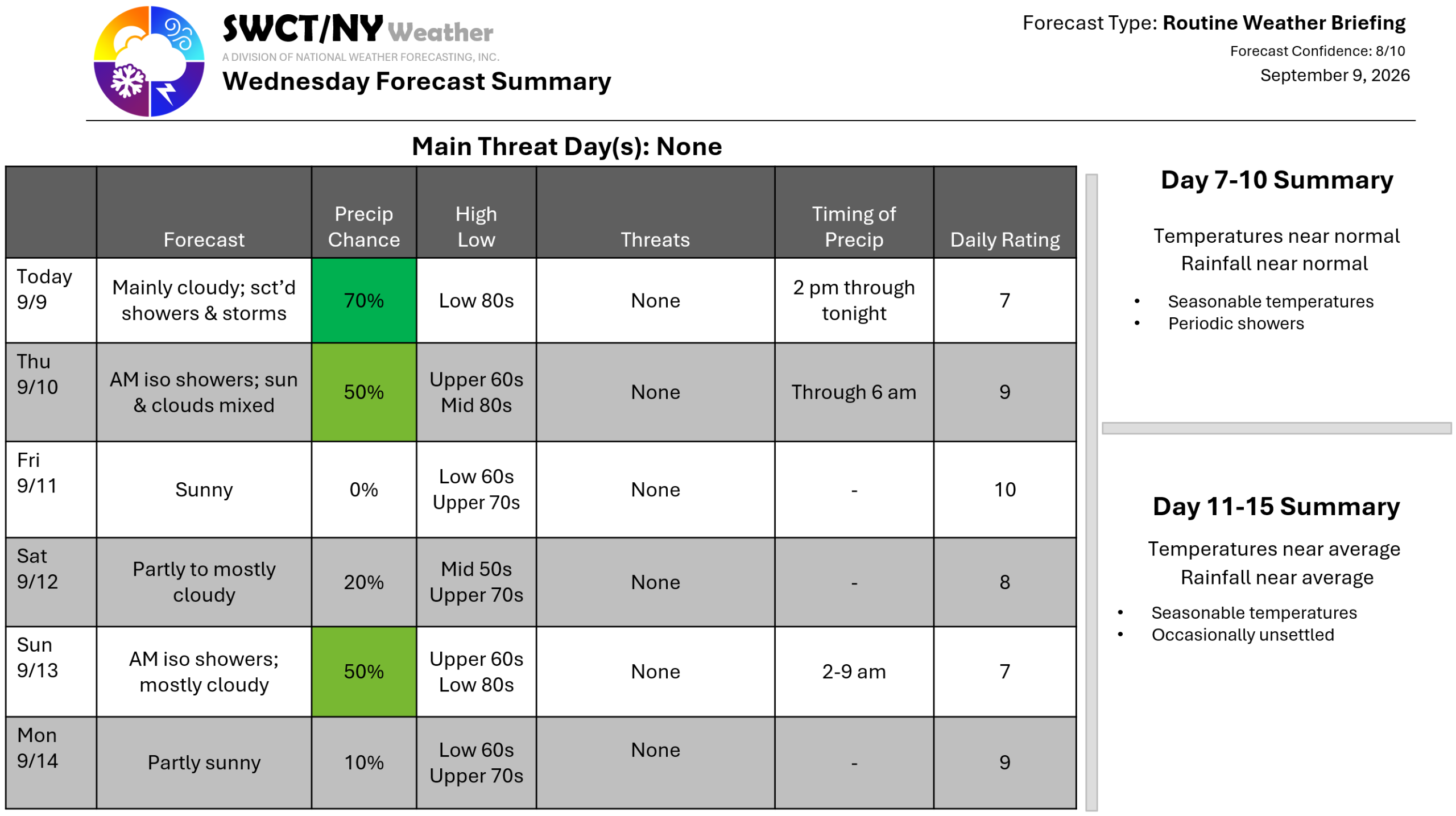
Good day! A cold front moving through the region from the eastern Great Lakes provides passing showers & storms this afternoon through sunrise tomorrow. Greatest risk for strong to severe storms remains across far southwestern New York through the Ohio Valley. Once this front clears the region to our east; surface high pressure builds in from the northern Plains which keeps us settled through much of the weekend. Some energy moving through from the Ohio Valley offers widely placed showers Sunday morning. Behind this pocks of energy; surface high pressure settled in again from the Great Lakes offering a settled start to next week. Enjoyable temperatures through the middle of next week with varying humidity. -Joe Sciacca
