Premium Weather Update April 3, 2026
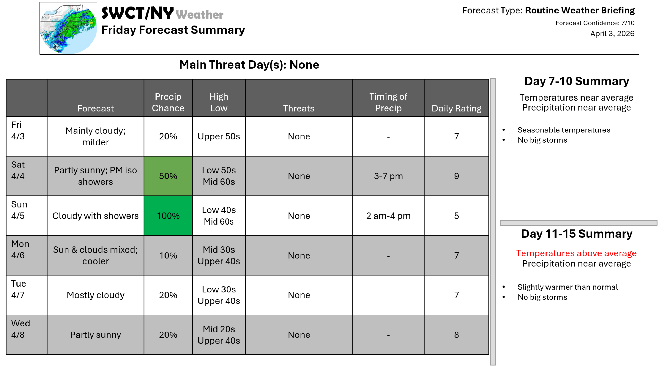
Good afternoon! Our backdoor cold front returns through this afternoon as a warm front from our southwest which provides milder temperatures through Easter. A cold front moving in & through from the Great Lakes Easter will bring rain & the risk of the risk of a few rumbles of thunder in the afternoon as it slides through. Cooler air; slightly below normal temperatures will follow this front to begin next week as surface high pressure builds in from the Great Lakes with varying cloud cover.
– Joe Sciacca
Be sure to update your account on the new swctweather.com/nationalweatherforecastinginc.com and watch for a resubscribe/renewal special in your inbox
