Premium Weather Update April 1, 2026
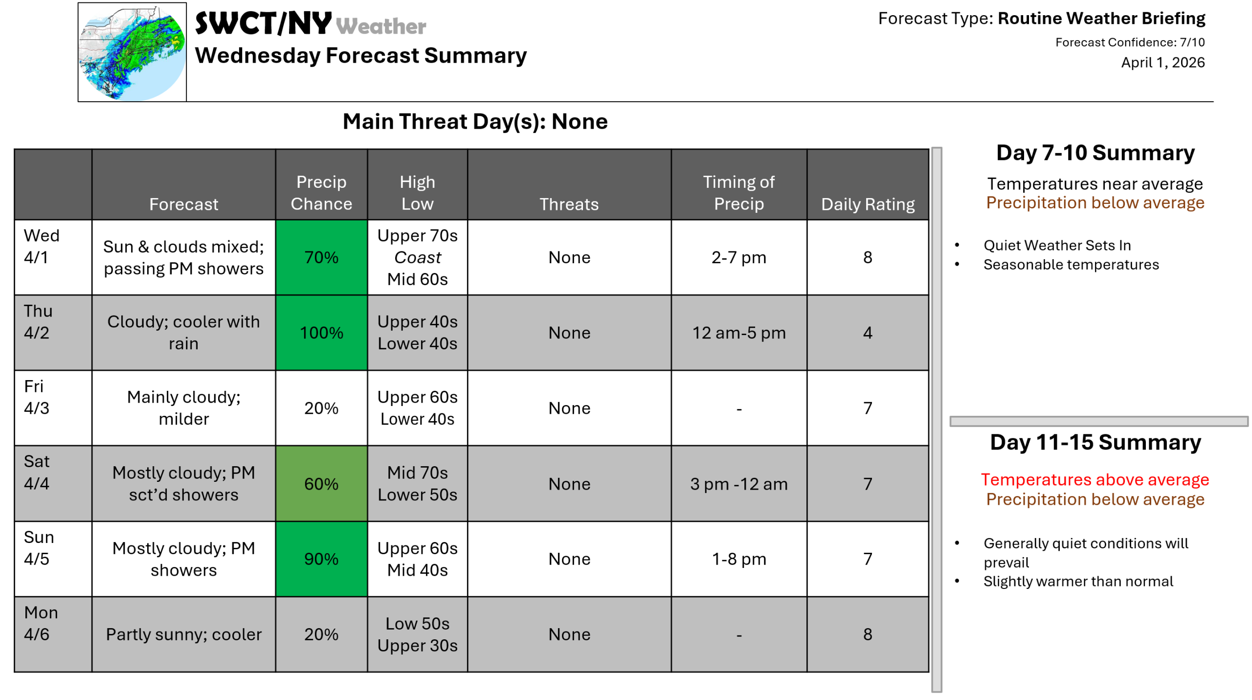
Good afternoon! We’ll have a mix of sun & clouds today with passing showers as some energy moves through from our west. Temperatures are mild again today ahead of a backdoor cold front moving through from our east tonight bringing much cooler temperatures which stay with us through Friday mid-morning. We’ll pick up more rain through tomorrow with around a quarter of an inch forecasted. A warm front moves through the region from our southwest Friday offering milder temperatures which last through Easter. A cold front moving in from the Great Lakes Sunday will bring afternoon & evening rain & the risk of some thunder as it slides through. Much cooler air will follow this front to begin next week as surface high pressure builds in from the Great Lakes.
– Joe Sciacca
Be sure to update your account on the new swctweather.com/nationalweatherforecastinginc.com and watch for a resubscribe/renewal special in your inbox
-Phil
