Premium Weather Update April 6, 2026
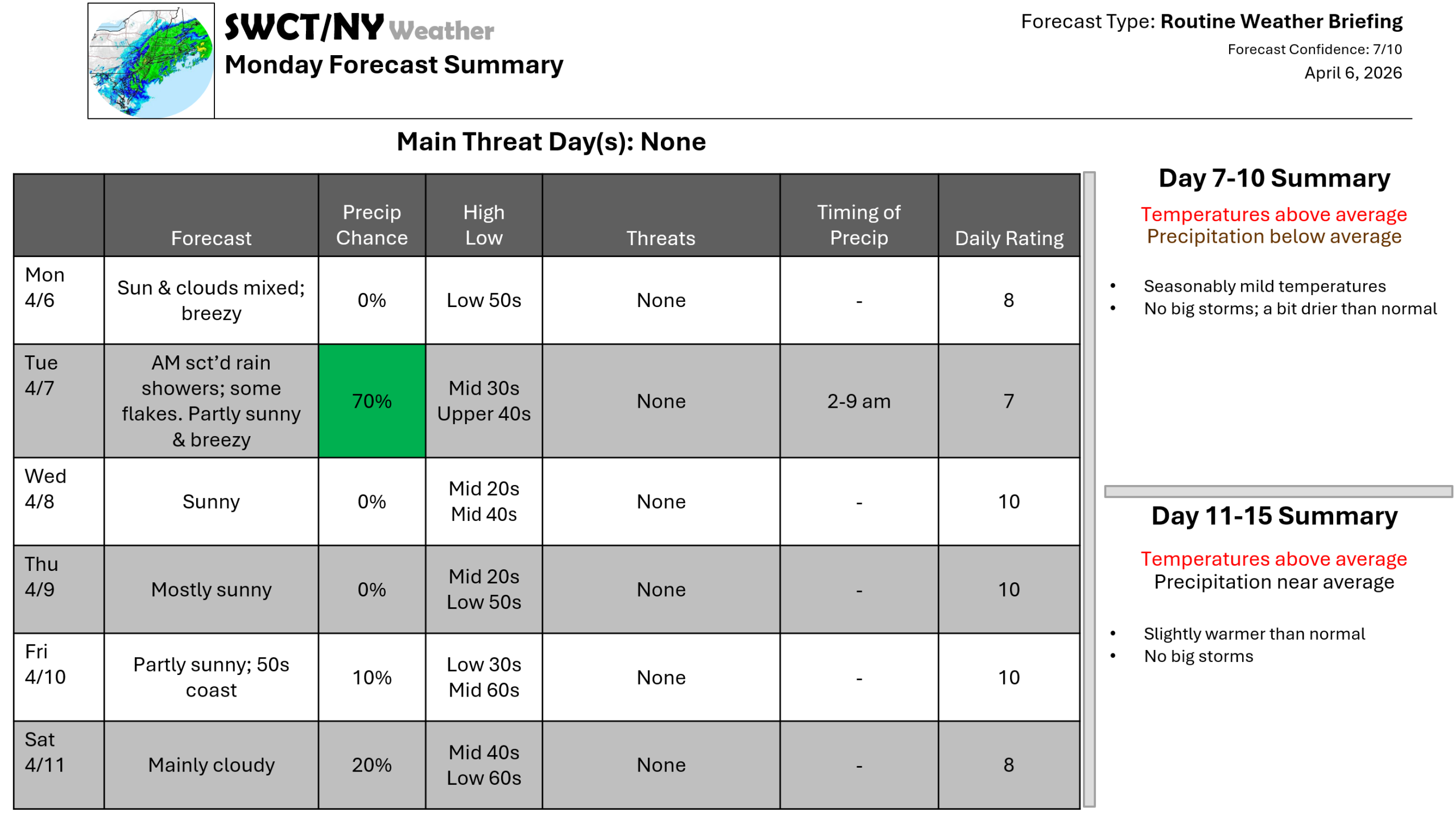
Good afternoon! Surface high pressure building in from the Great Lakes today offers a mix of sun & clouds along with a gusty wind through sunset gusting up to 30 mph. Slightly below normal temperatures are expected through Wednesday with moderation to above normal temperatures by weeks end into the weekend. No big storms are in sight with a weak storm system passing through the region from our west tonight offering a few passing rain showers with some wet flakes for some in the mix & a gusty breeze again tomorrow up to 35 mph. There are signs of a big warm up in about a week!
– Joe Sciacca
Be sure to update your account on the new swctweather.com/nationalweatherforecastinginc.com and watch for a resubscribe/renewal special in your inbox
