Premium Weather Update April 24, 2026
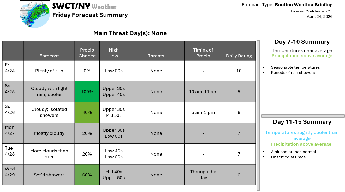
Good afternoon! Surface high pressure across the region keeps us dry through late tomorrow morning. We become unsettled late tomorrow morning through the afternoon as some energy passes from the eastern Great Lakes offering showers that evolves into a light rain for tomorrow night that tapers to widely placed showers for the second part of the weekend. Hit & miss showers are the theme for next week with more clouds than sun as pockets of energy move through from the Great Lakes & Ohio Valley. Seasonable temperatures are with us to close out the month.
-Joe Sciacca
Be sure to update your account on the new swctweather.com/nationalweatherforecastinginc.com and watch for a resubscribe/renewal special in your inbox
