Premium Weather Update May 18, 2026
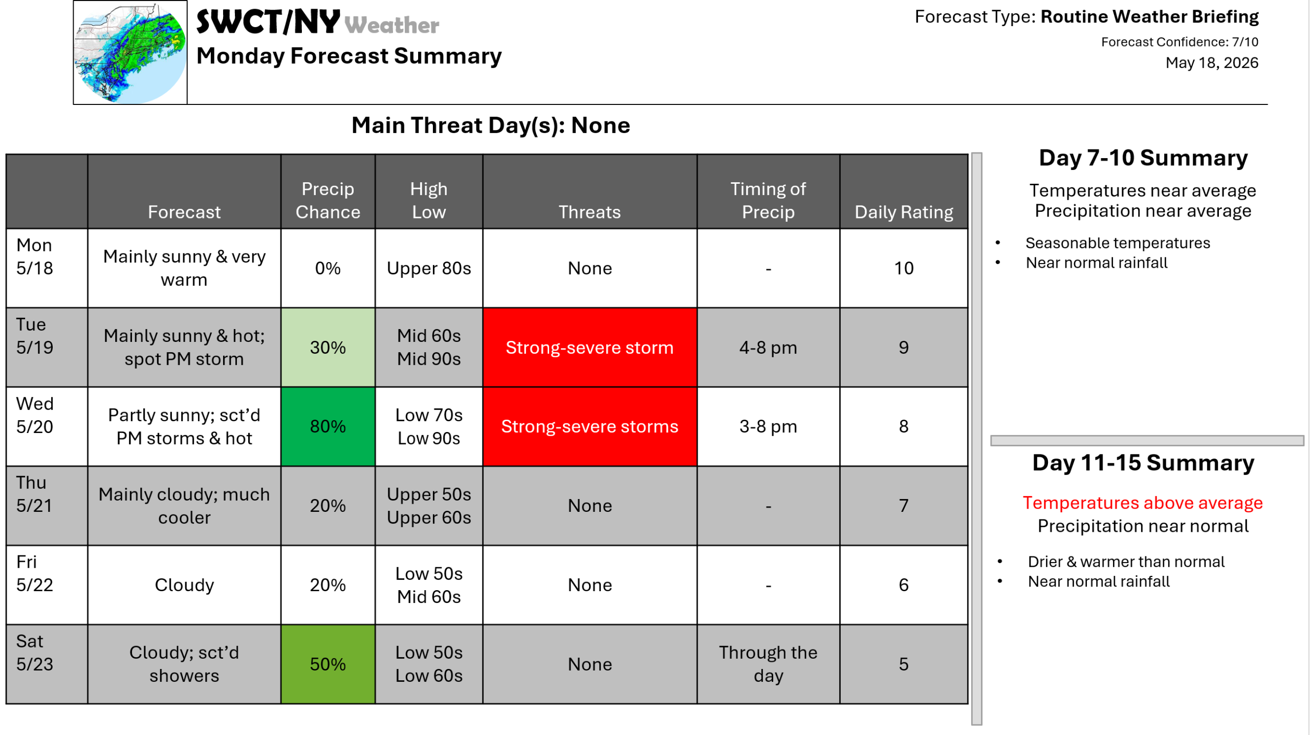
Good afternoon! Surface high pressure centered off to our south & strong mid level high pressure over the region keeps us dry & very warm to hot through mid week with tomorrow & Wednesday being the by far the hottest days of the next few weeks with record high temperatures expected for some. A strong cold front moving through from the Great Lakes offers mid afternoon through early evening storms Wednesday with the potential for severe storms being capable of producing strong to damaging wind gusts up to 60 mph. There is a very low risk of a strong to severe storm tomorrow afternoon. High temperatures mainly in the 80s at the south facing coast. Much cooler air moves in for late week behind this cold front with more clouds than sun. The weekend looks unsettled as some energy moves through from our west. -Joe Sciacca
