Premium Weather Update June 8, 2026
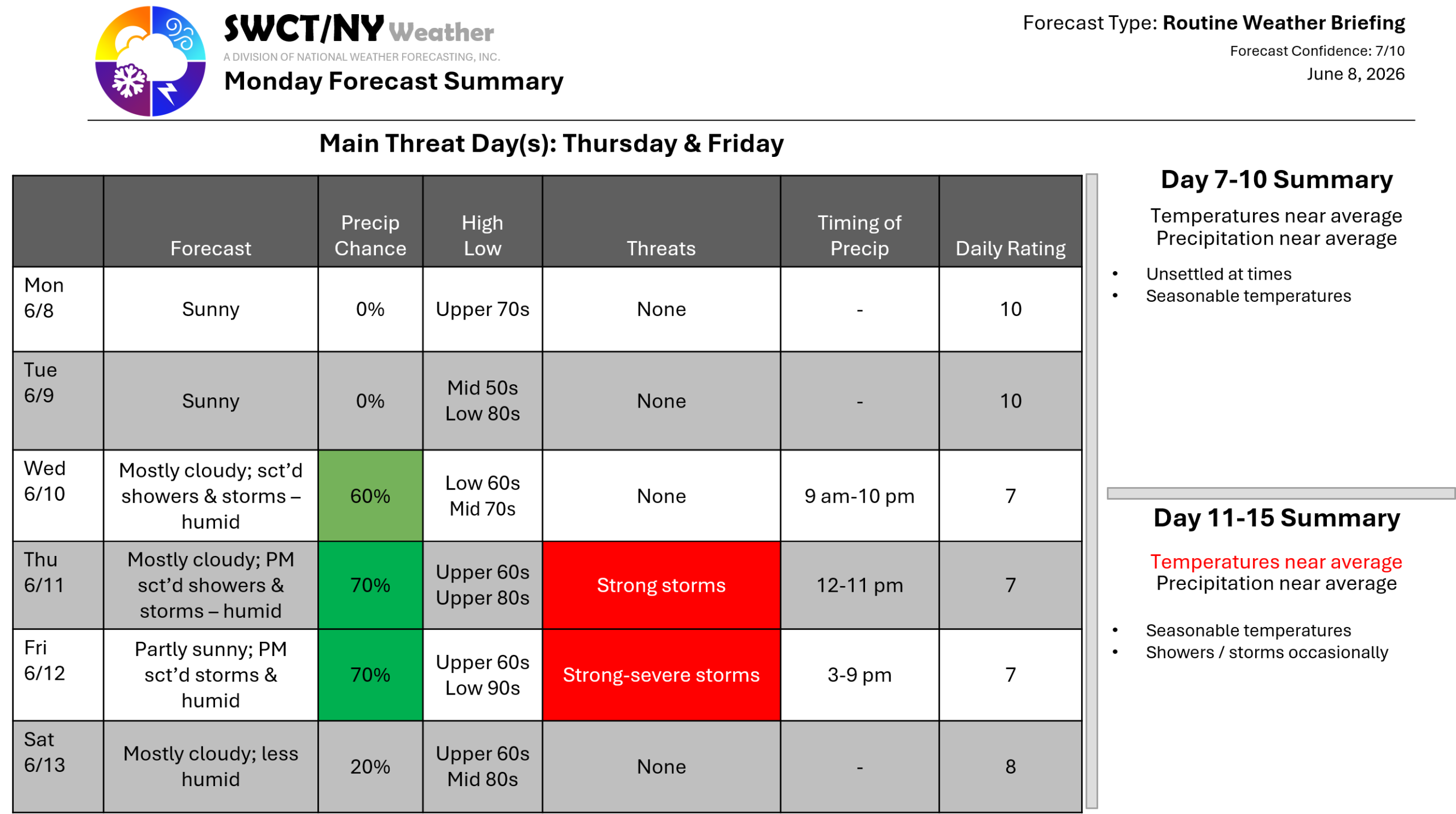
Good day! Surface high pressure across the region & centered to our south keeps us dry through mid Wednesday morning. Some energy moves through Wednesday mid morning through late Wednesday evening from the eastern Great Lakes offering hit & miss showers & thunderstorms. No strong to severe storms are expected. Above normal temperatures stay with us through the weekend as a strong ridge of mid-level high pressure builds over the region. Another pocket of energy moving through from the Great Lakes provides hit & miss showers & storms Thursday afternoon through late evening with the potential for strong to damaging wind gusts. A cold front nearing from the eastern Great Lakes introduces the potential for strong to severe storms Friday afternoon & evening being capable of producing strong to damaging wind gusts. This part of the forecast will be monitored over the coming days. Humidity also increases Wednesday & stays muggy to humid through the first part of the weekend. -Joe Sciacca
