Premium Weather Update June 15, 2026
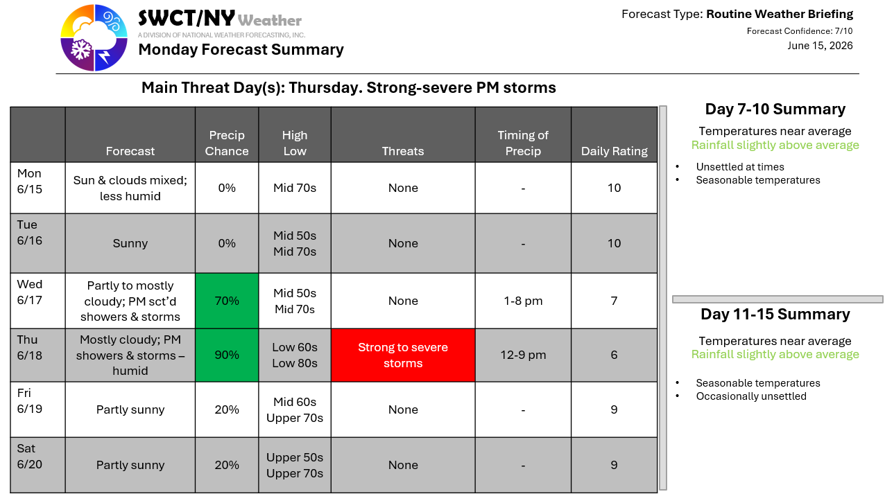
Good afternoon! We begin the week dry with lower humidity & seasonable temperatures thanks to surface high pressure residing across the region. Wednesday offers the risk of hit & miss afternoon & early evening showers & storms as some energy passes through from the Ohio Valley. Thursday afternoon & evening becomes unsettled again as a potent storm system passes by to our north across southern Quebec offering the risk of afternoon & evening showers & storms as a cold front moves through the region from the eastern Great Lakes. There is the potential for strong to severe storms being capable of producing strong to damaging wind gusts. Drier conditions with varying cloud cover look to close out the week & begin the weekend as surface high pressure builds in from the Great Lakes.
-Joe Sciacca
