Premium Weather Update June 12, 2026
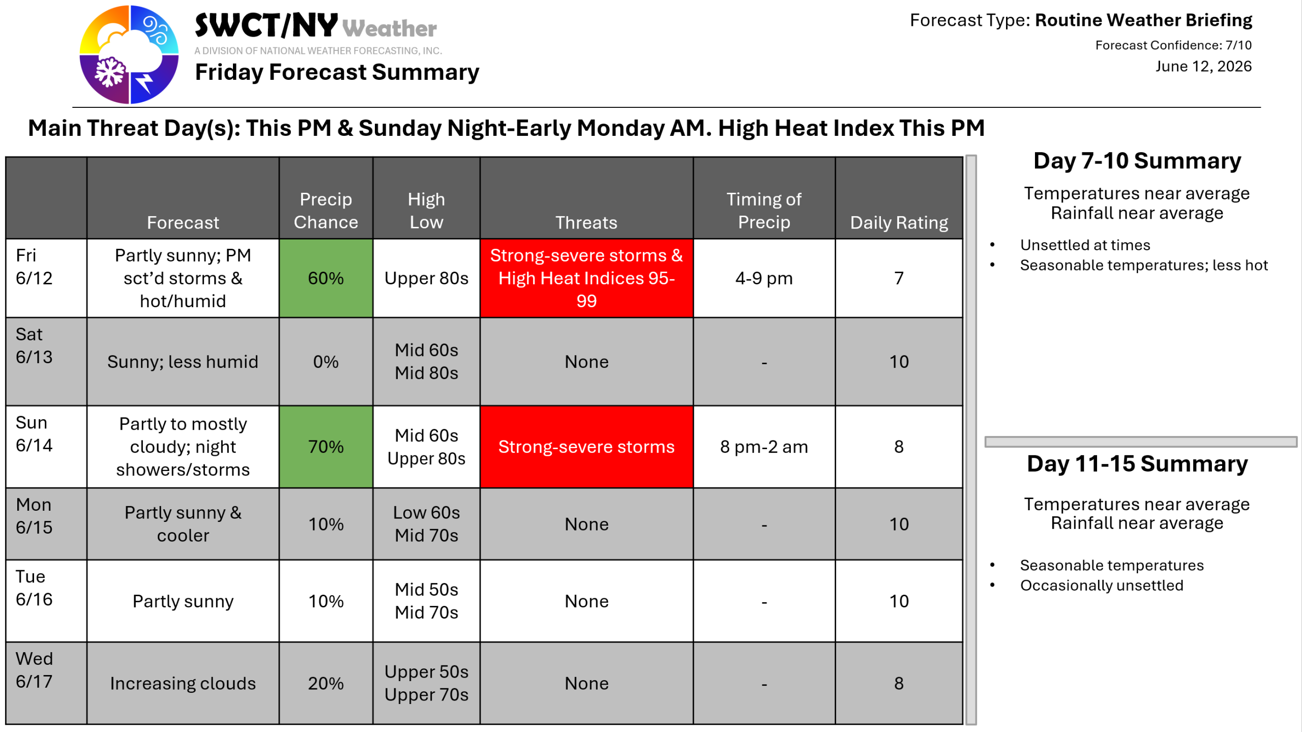
Good afternoon! Surface high pressure across the region & centered to our south keeps us dry for most if not all of the afternoon through tonight. Another hot & humid day is underway. We run the risk again of a few passing storms late this afternoon through this evening as a cold front nears from our west. There is the potential for strong to potentially damaging wind gusts with any storm that does move through. A reduction in the humidity arrives tomorrow behind our cold front with temperatures still well above normal through Sunday.
A potent cold front moves through from the eastern Great Lakes Sunday night offering a widespread rain with some storms in the mix with the potential for strong storms being capable of producing strong to damaging wind gusts. A much cooler & less humid air-mass moves in from the Great Lakes to start next week as a ridge of surface high pressure builds in.
-Joe Sciacca
