
Premium Weather Update September 16, 2026
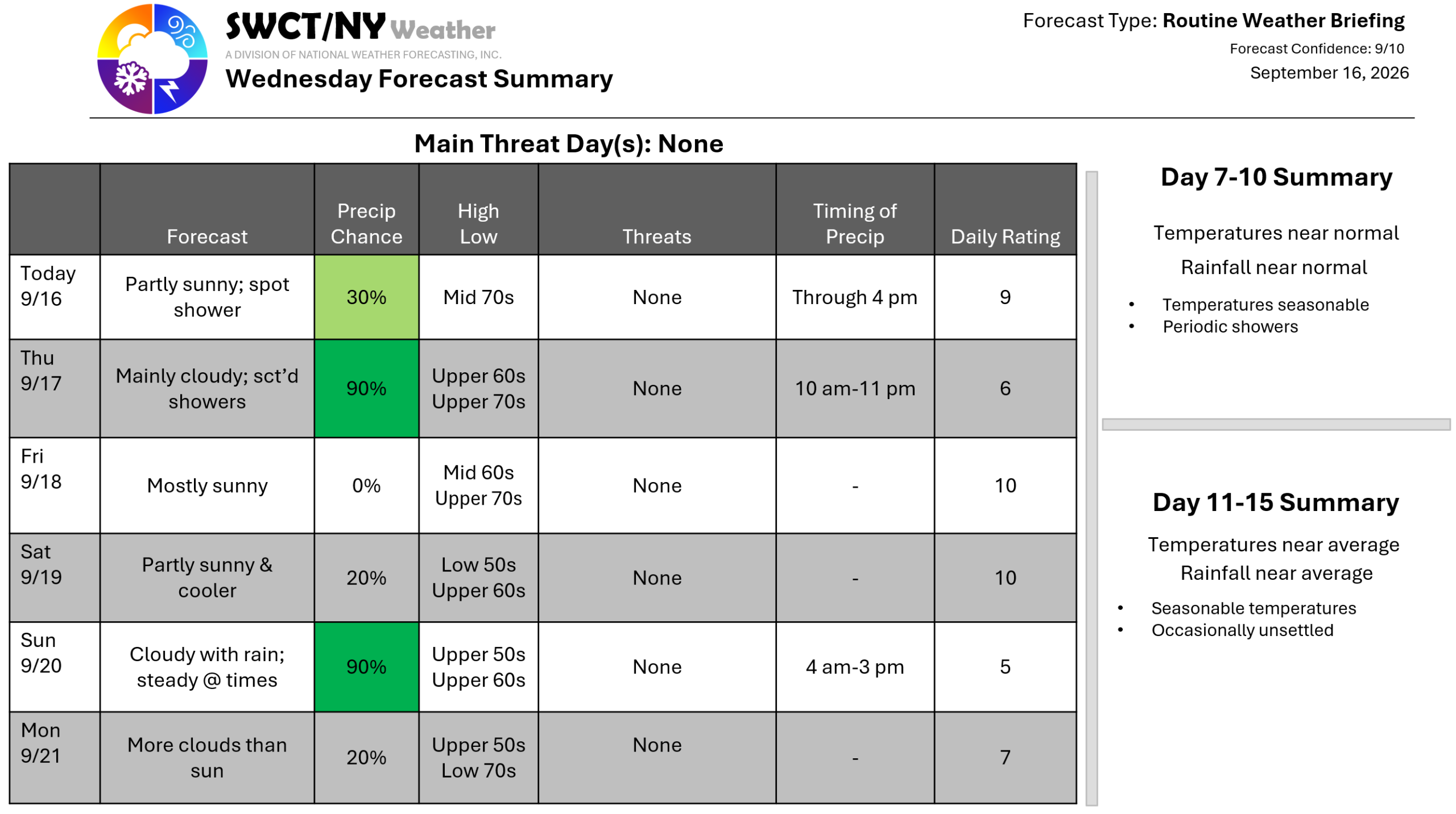
Good day! Surface high pressure across the region keeps us mainly settled through mid forming tomorrow. A passing shower or two can’t be ruled out over the next few hours this afternoon. Some energy moving through from the eastern Great Lakes offers passing showers through much of the day tomorrow through late tomorrow evening. Behind that batch of showers; a new ridge of surface high pressure builds in from southern Canada providing cooler & settled conditions to end the week & for the start of the weekend. By Sunday we become unsettled again as a weak storm system moves through from the eastern Great Lakes offering rain; steady at times. As of now no flooding rain is forecasted. Once this system clears to our east late day; we’ll see drying as surface high pressure builds in from our west which sets up a milder Monday with more clouds than sun. -Joe Sciacca
