
Premium Weather Update September 25, 2026
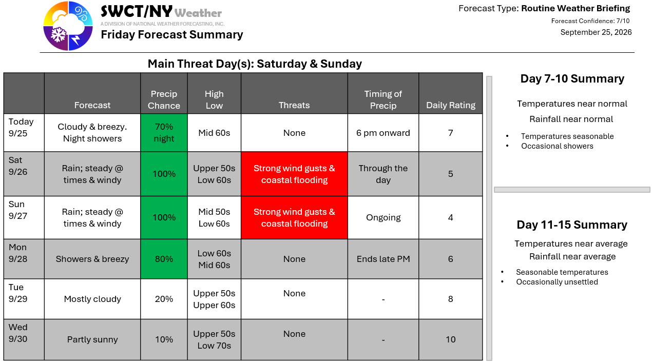
Happy Friday! Our coastal storm moves north through late tomorrow evening making its closest pass late tomorrow evening through Sunday evening as it moves up to 40N along 72-73W then west down 40N eventually coming ashore or very close to the northern New Jersey coast. We’ll see showers this evening through tomorrow morning with the peak of the rain & wind tomorrow afternoon through Sunday mid afternoon. By storms end 3-5″ of rain is forecasted with locally up to 7″. Wind gusts of 45-55 mph are expected with the highest wind gusts at the coast. Up to 3 feet of storm surge is expected at the coast around high tides through the weekend. Scattered tree damage & power outages are expected from the wind. Once this storm clears the region to our east Monday evening; surface high pressure builds in from our west offering settled conditions. Milder temperatures look likely by the end of next week. – Joe Sciacca
