
Premium Weather Update August 17, 2026
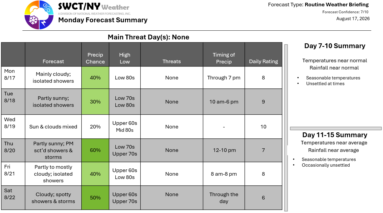
Good afternoon! A weak storm system passing just to our south & southeast offers a few widely placed showers through early this evening. Once this system clears the region to the east tonight; a new ridge of surface high pressure builds in from our southwest offering dry conditions tomorrow & Wednesday. A cold front nearing & moving through from the Great Lakes offers widely placed showers & some thunderstorms Thursday afternoon. A few showers linger for the day Friday with most of the day remaining dry. Our weekend starts off unsettled as some energy moves through from the eastern Great Lakes. No heavy rainfall is on the horizon or high heat. Seasonable temperatures are ours through the longer term.
-Joe Sciacca
