
Premium Weather Update November 20, 2026
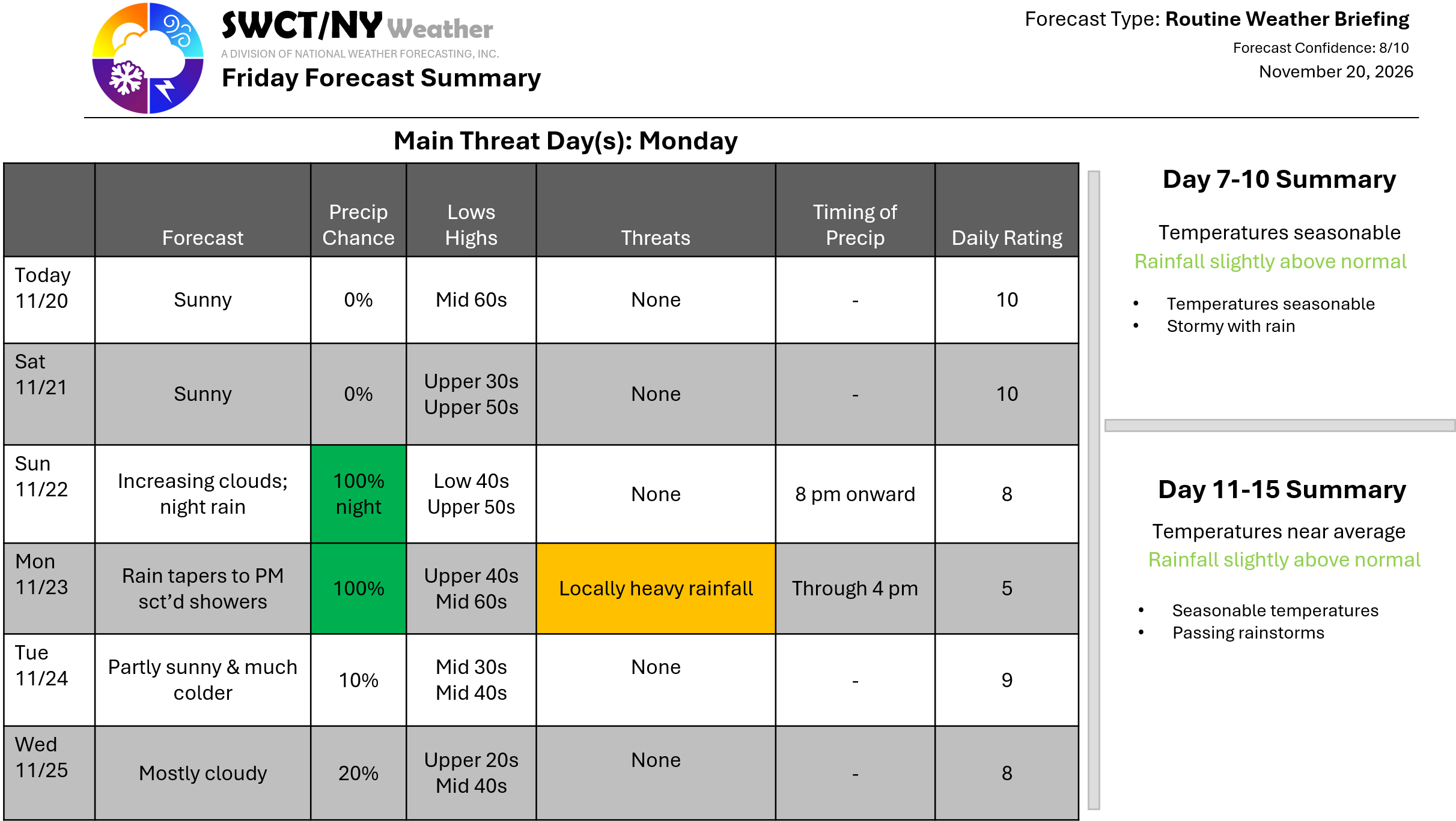
Happy Friday! High pressure is in control across the region through the day Sunday. Temperatures remain warmer than normal through Monday. A robust coastal storm moving up from our south offers rain; locally heavy Sunday night through mid morning Monday before tapering to spotty showers for Monday afternoon as it merges with a cold front that will be just to the west. Since there is tropical moisture with our storm; there is the potential for locally heavy rainfall of 3-5″. Not much wind with our storm with wind gusts up to 25 mph. Much colder air moves in Monday night from the Great Lakes as a new ridge of strong surface high pressure builds in. We are keeping an eye on another coastal storm by Thanksgiving which looks more impactful as of now. More on this storm Monday! – Joe Sciacca
