Premium Weather Update June 5, 2026
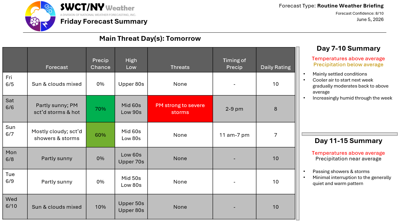
Good afternoon! Surface high pressure across the region keeps us settled through early tomorrow afternoon. Above normal temperatures are with us today & tomorrow as a strong mid-level ridge of high pressure resides over the region. Slightly cooler temperatures close out the weekend & start next week as a cold front moves through from the Great Lakes through the day Sunday offering hit & miss showers & storms. Tomorrow afternoon & evening offers the potential for strong to severe storms being capable of producing damaging wind gusts up to 60 mph & small hail. Temperatures moderate by the middle of next week as a new ridge of mid level high pressure builds over the region with a high risk of hot high temperatures to close out next week. -Joe Sciacca
