Premium Weather Update June 3, 2026
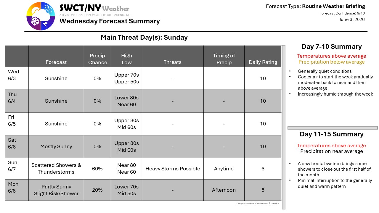
Clear and dry weather stretches from the Southeast westward beyond the Mississippi this morning, with shower activity across the eastern United States largely confined to areas near the Gulf Coast. The area of high pressure responsible for this quiet pattern will strengthen and expand eastward over the next few days, allowing progressively warmer air to spread into the Northeast.
Temperatures continue to climb through the end of the week, while humidity levels increase gradually. A slow-moving frontal boundary then approaches for the weekend, bringing a growing risk for showers and thunderstorms, some of which could produce heavy rainfall. Slightly cooler air follows into early next week, though temperatures should remain generally seasonable.
