
Premium Weather Update July 17, 2026
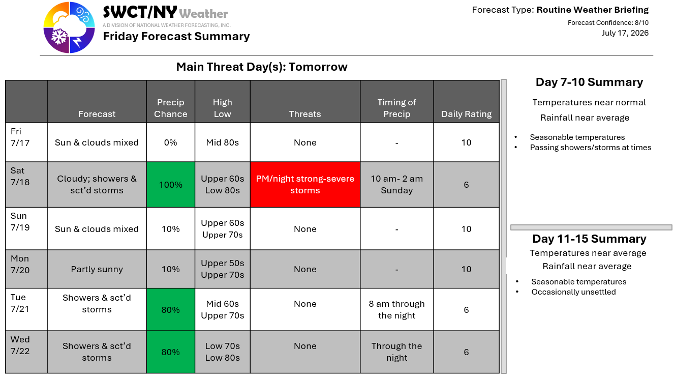
Good afternoon! Surface high pressure & mid-level high pressure is in control through late tomorrow morning. A storm system passing by across southern Quebec offers showers & hit & miss storms tomorrow afternoon through the predawn hours Sunday. There is the potential for severe storms being capable of producing damaging wind gusts & a very low risk of a weak short lived tornado. Once this system clears to our east; we’ll see varying cloud cover Sunday into Monday as surface high pressure builds in from the eastern Great Lakes. Another storm system & cold front moving through from the Great Lakes offers showers & storms Tuesday & Wednesday.
– Joe Sciacca
